McEvoy, Peter M. (Curtin University, Saulsman, Lisa M., Rapee, Ronald M.
€52.30
WonderWord Volume 36
Ouellet, David, Ouellet, Sophie, Boragina, Linda
€14.45
Creationism's Trojan Horse
Forrest, Barbara (Associate Professor of Philosophy, Gross, Paul R. (University Professor of Life Sciences
€40.65
WonderWord Volume 29
Ouellet, David, Ouellet, Sophie, Boragina, Linda
€14.45
Eastern State Penitentiary: A History
Kahan, Paul
€39.20
World History of the Dance
Sachs, Curt
€39.10
Game Changer
Lawson, Piper
€31.10
Small Talk that Doesn't Suck
King, Patrick
€33.50
From Hoodies to Suits
Osborne, Annelise
€30.40
Ein Brief über Toleranz
Locke, John
€27.90
History and Crime
Godfrey, Barry, Lawrence, Paul M., Williams, Chris A
€65.85
The Sentinel
Clarke, Arthur
€47.50
Fearless Firsts: Artists Who Changed Entertainment
Jr., James Buckley, Labrecque, Ellen
€19.95
Empire of the Summer Moon
Gwynne, S.C.
€22.15
De trein
Vickery, Bo
€16.99
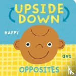
Upside Down Opposites
McLean, Danielle
€13.25
Dynasties
Thompson, Marcus
€29.50
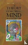
The Theory of Material Mind
Hodgetts, Philip
€28.05
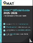
GMAT Official Guide 2025 - 2026
GMAC (Graduate Management Admission Council)
€45.35
Your Daily Veg
Woodhouse, Joe
€28.45
A Sketch of the Willis Family of Virginia, and of Their Kindred in Other States. With Brief Biographies of the Reades, Warners, Lewises, Byrds, Carters, Champs, Bassetts, Madisons, Daingerfields, Thorntons, Burrells, Taliaferros, Tayloes, Smiths, An
Willis, Byrd Charles 1847-1912
€20.55
The Nine Realms: Eve of War
Bury, Tony
€24.10
Couples
Stewart, Michael
€13.25
Wildcat Women
Williams, Carla
€29.60
Shortcut
Crews, Donald
€11.05
GMAT Official Guide Verbal Review 2025-2026
GMAC (Graduate Management Admission Council)
€31.05
Dinosaurs
Naish, Darren, Barrett, Paul M.
€25.50
O'Hagan, A: Caledonian Road
O'Hagan, Andrew
€37.40
Alles over de Duitse Herder
B.V., Andries
€15.95
Cambridge IGCSE™ Physics Study and Revision Guide Third Edition
Folland, Mike, Jones, Catherine
€35.95
Marengo Het meest verziekte en vergiftigde proces ooit
Witte, Marieke de
€29.95
Patina Modern
Mitchell, Chris, Guzman, Pilar
€34.85
Essential Questions to Master the California Seismic Principles Exam
Petro, Jacob
€92.10
Familiar Spanish Travels
Howells, William Dean
€39.60
The Proximity Principle: The Proven Strategy That Will Lead to a Career You Love
Coleman, Ken
€33.80
Penny Pepper 7 - Diebesjagd in London
Rylance, Ulrike
€20.50
Siege of Malta 1940-42
Rogers, Anthony
€21.60
GMAT Official Guide Quantitative Review 2025-2026
GMAC (Graduate Management Admission Council)
€25.50
The Arab-Israeli War of Attrition, 1967–1973 Volume 3
Norton, Bill
€29.45
The Rabbi and the Hit Man
Magida, Arthur J
€23.00
Princeton Review AP Calculus AB Premium Prep, 12th Edition
Khan, David
€34.50
World of Warcraft: Thrall: Twilight of the Aspects