Agapit, Marc, Lofficier, Jean-Marc, Lofficier, Randy
€15.05
Cursum Perficio
Vitacco-Robles, Gary
€37.40
Dive Truk Lagoon, second edition
Macdonald, Rod
€40.00
The Highland Lodge Getaway
Shackman, Julie
€13.95
Surge
Sinclair, M.
€29.10
Zigzag
Gambone, Philip
€28.10
The Spy in Question
Sebastian, Tim
€20.20
The Nature of Christ
Shenouda, H H Pope
€10.95
Stewart, K: Finish Line
Stewart, Kate
€26.30
An Ultra Marathoner's Journey: As Hope Springs Eternal on Trails to the Finish Line
Andrish, Jack
€36.20
Dogra Magra
Ky¿saku, Yumeno
€50.40
Marcús, J: After December
Marcús, Joana
€27.10
Self Storage Wars
Monastyrski, Ginger
€29.10
Bill & Ted's Most Excellent Movie Book
Shapiro, Laura J.
€29.50
Rosa
Giovanni, Nikki
€16.45
Nourish & Glow: The 10-Day Plan
Freer, Amelia
€23.55
Development of Next Generations of Army Aviation Systems
Schrage, Daniel P.
€26.40
The Highwaymen
Monroe, Gary
€39.20
Executive Intelligence
Menkes, Justin
€22.30
Marshmallow Martians: Earth School
Kent, Deanna, Hooson, Neil
€13.95
Beneath the Poet's House
Carmen, Christa
€12.60
Choose It! Videogame Edition
Welbeck Children's Books
€12.25
Golestan
Monadjemi, Lily
€27.45
Living in Squares, Loving in Triangles
Licence, Amy
€19.95
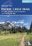
Hiking the Pacific Crest Trail
Jordan, David
€36.15
Reeds Outboard Motor Troubleshooting Handbook
Pickthall, Barry
€14.25
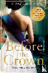
Before the Crown
Harding, Flora
€13.95
Motorrad Reiseführer Biker Weekends Nachbarländer
Fennel, Stephan, Simicic, Snezana
€30.40
A Universe Revealed
Schrader, Eric von
€28.10
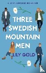
Three Swedish Mountain Men
Gold, Lily
€21.70
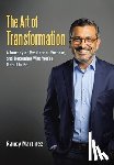
The Art of Transformation: A Journey of Resilience, Purpose, and Becoming Who You're Meant to Be
Martinez, Randy
€39.20
Timber and Lua
Hong, Lily, No, Vi Khi
€35.90
Curtain Call at the Seaview Hotel
Young, Glenda
€14.95
Lieselle's Eternal Tarot: Trust Your Voice and Then Learn to Trust the Journey (Tarot Kit Box Set with 78 Cards and Guide Book) [With Guide Book]
Elliot, Lieselle
€39.70
Hand-Rearing Birds
€155.30
Media Parenting
Rasmussen, Eric E. (Texas Tech University
€36.70
The Top 8 Most Powerful Pharaohs of Egypt - Biography for Kids | Children's Historical Biographies
Baby
€27.10
Surviving Slavery in the British Caribbean
Browne, Randy M.
€33.35
Chelsea and Synthetic Emerald Testers Made Easy
Matlins, Antoinette
€12.45
Gothic Art Nouveau
€22.60
WHAT HAVE YOU FORBES'D LATELY?
Riley, Forbes
€44.10
Unit 731
Pua, Derek, Dybbro, Danielle, Rogers, Alistair
€17.05
Chris Beat Cancer
Wark, Chris
€23.55
Memoirs of a Mansion
Pritchett De Martini, Phyllis
€30.60
Ethereal Visions
Hughes, Matt
€31.00
There are Bugs Everywhere
Murray, Lily
€13.25
Nonprofit Management
€144.00
Lightman, A: Einstein's Dreams
Lightman, Alan
€21.50
LEGO Train Projects
Pritchett, Charles
€27.00
The Columbia Anthology of Modern Chinese Literature
€68.80
The United Nations and Changing World Politics
Weiss, Thomas G., Forsythe, David P., Coate, Roger A., Pease, Kelly-Kate
€63.60
Trucks, Trains and Big Machines! Transportation Books for Kids | Children's Transportation Books
Baby
€39.20
ANNABEL KARMELS FUN FAST & EAS
Karmel, Annabel
€26.40
The Later Roman Empire
Cameron, Averil
€17.05
Better To Have Gone
Kapur, Akash
€14.95
Your Competent Child
Juul, Associate Professor Jesper (The Royal Danish Academy of Fine Arts)
€22.20
PEPFAR Implementation
Institute of Medicine, Board on Children, Youth, Board on Global Health, Committee for the Evaluation of the President's Emergency Plan for AIDS Relief (PEPFAR) Implementation
€63.35
Karl der Große
Becher, Matthias
€17.05
Mossback
Pritchett, David Michael
€20.60
The Cottage in the Highlands
Shackman, Julie
€13.95
Speelruimte
Wolbert, Lynne
€28.99
Het geschenk
Fitzek, Sebastian
€26.99
Stuntvlogger Sam en de wolf van Weverseind
Jepsen, Jelmer, Steen, Wilbert van der
€18.99
Donizetti: Lucia di Lammermoor
Pottinger, Mark A. (Manhattan University
€27.50
Social Intrapreneurism and All That Jazz
Grayson, David, McLaren, Melody, Spitzeck, Heiko
€55.80
The Life of Chuck
King, Stephen
Dit boek is op dit moment nog niet leverbaar. De geplande verschijningsdatum is 30-04-2026.
€12.99
Blues
Hersey, John
€22.30
Read Write Inc. Phonics: A Mouse in the House (Yellow Set 5 Non-fiction 5)
Munton, Gill
€12.35
Little Manfred
Morpurgo, Michael
€13.25
Firefight
Sanderson, Brandon
€14.95
And This Too Shall Pass
Harris, E. Lynn
€24.90
Graph Paper Composition Notebook: 110 Pages - Quad Ruled 4x4 - 8.5" x 11" Marble Large Notebook with Grid Paper - Math Notebook For Students
Notebooks, Exciting
€16.15
Old Broughton, Drumelzier, Manor, Stobo and Tweedsmuir
Matheson, Ann
€14.65
Het Huis Oranje-Nassau
Huijzer, Marlies
€18.95
A Brush with the Borders
Moore, Kathryn
€31.40
River of Angels
Cooper, Stephen
€28.10
Ramsey Campbell
O'Sullivan, Keith M. C.
€74.65
A Book of Common Prayer
Didion, Joan
€21.50
Dreams
Welbeck Children's Books
€14.95
The Poison Jungle
Sutherland, Tui
€15.65
A Wartime Welcome from the Foyles Bookshop Girls
Roberts, Elaine
€28.40
Medieval Women Religious, c. 800-c. 1500
€40.30
Violet and the Jurassic Land Exhibit
Malia, Jen
€11.25
Essais
Montaigne
€11.50
Incidents of travel in Central America, Chiapas and Yucatan (1854) by John Lloyd Stephens, edited by Frederick Catherwood. / ILLUSTRATED /
Catherwood, Frederick
€33.20
The Imposters
Rachman, Tom
€25.25
KUNTH Gipfelstürmer
Blechschmidt, Gotlind, Möser, Christian
€38.90
Flirting with Pete
Delinsky, Barbara
€21.50
The Fourth Part of the World
Lester, Toby
€27.30
My Way Marco Polo Travel Journal - Cactus
Marco Polo
€16.35
Healing Mandala Pocket Colouring Book
Tenzin-Dolma, Lisa
€13.25
Marvel Comics In The 1970s Expanded Edition
Comtois, Pierre
€36.10
The Three-Fold Mimesis of Life
Barnes, Ronald
€47.50
Midsummer Night's Scream
Stine, R. L.
€24.90
Richard Scarry's Christmas Mice
Scarry, Richard
€10.30
Youth Beyond the Developmental Lens
Ellis, Wesley W.
€26.50
Better Than Fiction
Martin, Alexa
€28.10
Let's Study Philippians
Ferguson, Sinclair B.
€20.30
Der Wind in den Weiden
Grahame, Kenneth
€29.10
How to Read a Book
Adler, Mortimer J., Van Doren, Charles
€15.90
Read Write Inc. Phonics: Green Set 1 Core Black & White Storybooks (Mixed Pack of 10)
Munton, Gill
€27.65
Sticker Activity Set: Wild Woodland
Petit Collage
€14.95
De leider als spelverdeler
€23.50
De mijter af
Kerstjens, Frank
€17.50
How Do Fruits Smell? - Sense & Sensation Books for Kids
Baby Professor
€25.60
Leonardo Da Vinci Playing Cards
€12.75
David Hume: An Enquiry concerning the Principles of Morals
€78.40
Family Nurse Practitioner Certification Exam Premium: 4 Practice Tests + Comprehensive Review + Online Practice
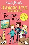
Famous Five Colour Short Stories: The Painting Puzzle
Blyton, Enid, Ahmed, Sufiya
€13.25
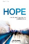
Hope
Peters, David
€14.50
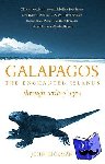
Galapagos
Hickman, John
€19.95
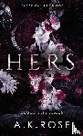
Hers
Rose, A. K., Rose, Atlas
€34.50
Stories in the Stars
Ganeri, Anita
€15.10
Koch-Rezepte für Lina
Hoffmann, Heinrich
€20.80
Forbidden Cosmology
Franke, G. W.
€27.10
Love Story
Segal, Erich
€15.90
Coastal Environments in Popular Song
€55.80
Chocolate Milk and White Milk
Phipps, Dorothy
€23.80
Vikings in Scotland
Graham-Campbell, James (Professor of Medieval Archaeology
€39.05
Tales of Two Planets
Freeman, John, Atwood, Margaret, Roy, Arundhati
€19.95
Op het verkeerde been
Gemert, Gerard van
€11.95
Alpha to Omega Pack: Teacher's Handbook and Student's Book 6th Edition
Beve Hornsby, Frula Shear, Julie Pool
€95.10
Technogötter
Roth, Roland
€23.80
Francophone Sub-Saharan Africa 1880–1995
Manning, Patrick (Northeastern University
€47.65
Grid-Forming Power Inverters
€85.30
Art Therapy Techniques and Applications
Buchalter, Susan
€38.85
Winging It
Jefferson, Anna
€14.95
Running to Extremes
Scott Ludwig
€14.90
Read Write Inc. Fresh Start: 2024 Modules 6-10 - Pack of 5
Munton, Gill, Rushton, Abbie
€34.80
Spatial Regression Models for the Social Sciences
Chi
€96.10
Kants Prolegomena
€33.30
Wooden Puzzle + Play: Shaped Safari Animals
Petit Collage
€19.95
Honeycomb
Caves, S.B.
€19.95
Jana, 39, ungeküsst
Crämer, Jana
€21.60
An Introduction to Middle East Politics
Benjamin MacQueen
€44.50
International Finance: Theory and Policy, Global Edition
Krugman, Paul, Obstfeld, Maurice, Melitz, Marc
€90.20
Hunting and Trapping on the Upper Magalloway River and Parmachenee Lake
Barker, Capt Fred C, Danforth, J S
€23.85
RuPaul’s Drag Race UK
Guiltenane, Christian
€21.60
Norfolk, The Wash and Humber
Harvey, Peter
€28.95
For Better, For Worse
Isaac, Jane
€19.95
Love is an Illusion! Vol. 4
Fargo
€28.45
Restore Me
Mafi, Tahereh
€29.00
Beginner's Finnish with Online Audio
Risko, Agi
€24.90
Read Write Inc. Phonics: A Good Cook? (Orange Set 4 Storybook 6)
Munton, Gill
€11.75
Mijn pony invul dagboek groen
Degenaar, Kris
€29.95
Project X Origins: Gold Book Band, Oxford Level 9: Pirates: Nasty Nate's Pirate Adventure
Vaughan, Marcia
€14.25
Paleontologist
Dumas, Luke
€24.50
Blackwater Estuary
Ordnance Survey
€19.95
Teachings of the Hindu Mystics
Harvey, Andrew
€14.95
Verzamelbundel II: 20 korte geschiedenisverhalen
€17.50
Elementary Hindi Workbook
Delacy, Richard, Joshi, Sudha
€21.60
Y41 Teignmouth and Tor Bay (Small Format)
Imray Y Series
€27.20
A Cheshire 1611 - 1840 - Fold Up Map that features a collection of Four Historic Maps, John Speed's County Map 1611, Johan Blaeu's County Map of 1648, Thomas Moules County Map of 1840 and Cole and Roper's Plan of the City of Chester 1805.


![Elliot, Lieselle - Lieselle's Eternal Tarot: Trust Your Voice and Then Learn to Trust the Journey (Tarot Kit Box Set with 78 Cards and Guide Book) [With Guide Book]](https://images.boekstra.nl/medium/boekstra_9780764369759_front.jpg)