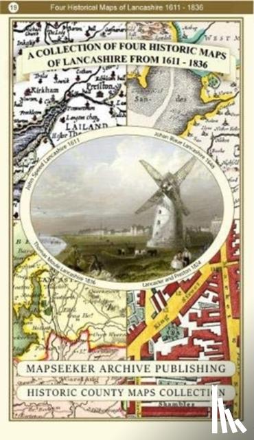
A Lancashire 1611 - 1836 - Fold Up Map that features a collection of Four Historic Maps, John Speed's County Map 1611, Johan Blaeu's County Map of 1648, Thomas Moules County Map of 1836 and a Plan of Lancaster and Preston from 1824. The maps also fe
€ 29.50
Paperback
Surminski, Arno
Als der Krieg zu Ende ging
€ 20.40
Gebonden
Dillon, John
Battalions at War
€ 40.85
Paperback / softback
McEnery, Professor Anthony (University of Lancaster, Baker, Dr Helen (University of Lancaster