Collins Map of France

Collins Maps

Omschrijving

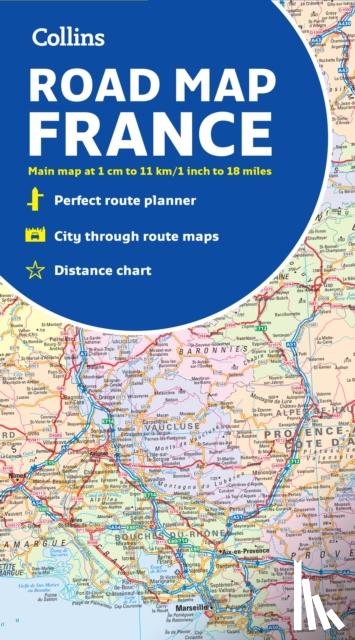
A fully revised and updated colour road map of France at 18 miles to 1 inch / 11km to 1cm (1:1,120,000). The map shows individual departments by name. All cities, towns, roads, European route numbers, motorways and toll motorways are clearly shown, making it the ideal map for planning and route-finding.
€ 12,35
Topografische kaarten
 
Gratis verzending vanaf
€ 19,95 binnen Nederland
Schrijver
Collins Maps
Titel
Collins Map of France
Uitgever
HarperCollins Publishers
Jaar
2022
Taal
Engels
Pagina's
2
Gewicht
130 gr
EAN
9780008403980
Afmetingen
140 x 251 x 17 mm
Bindwijze
Topografische kaarten

U ontvangt bij ons altijd de laatste druk!


Rubrieken

Boekstra