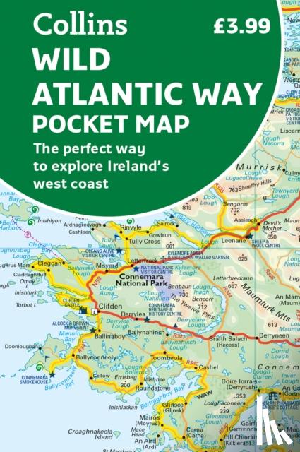
Explore new places with handy pocket maps from Collins. Handy full-colour map of Ireland’s Wild Atlantic Way with a high level of detail. Clear mapping of the full 2500 km (over 1500 miles) route, showing the road network and places of interest.
Ik heb een vraag over het boek:
‘Wild Atlantic Way Pocket Map - Collins Maps’.
Vul het onderstaande formulier in.
We zullen zo spoedig mogelijk antwoorden.