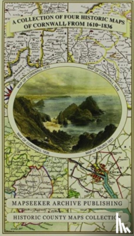
Cornwall 1611 - 1836 - Fold Up Map that features a collection of Four Historic Maps, John Speed's County Map 1611, Johan Blaeu's County Map of 1648, Thomas Moules County Map of 1836 and Robert Dawson's Reform Act Plan of Truro 1831. The maps are sur

Mapseeker Publishing Ltd.

Omschrijving

Er is geen omschrijving gevonden.

€ 29,50
Topografische kaarten
 
Gratis verzending vanaf
€ 19,95 binnen Nederland
Schrijver
Mapseeker Publishing Ltd.
Titel
Cornwall 1611 - 1836 - Fold Up Map that features a collection of Four Historic Maps, John Speed's County Map 1611, Johan Blaeu's County Map of 1648, Thomas Moules County Map of 1836 and Robert Dawson's Reform Act Plan of Truro 1831. The maps are sur
Uitgever
Historical Images Ltd
Jaar
2014
Taal
Engels
Pagina's
1
Gewicht
106 gr
EAN
9781844918256
Afmetingen
237 x 134 x 43 mm
Bindwijze
Topografische kaarten

U ontvangt bij ons altijd de laatste druk!


Rubrieken

Boekstra