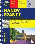
Philip's Handy Road Atlas France, Belgium and The Netherlands
Spiral A5
Omschrijving
Philip's Handy Road Atlas of France, Belgium and The Netherlands features new digital cartography from Philip's - voted Britain's clearest and most detailed European mapping in an independent consumer survey. This compact A5 atlas with lie-flat binding is perfect for travelling across France and the surrounding countries.
Ik heb een vraag over het boek:
‘Philip's Handy Road Atlas France, Belgium and The Netherlands - Philip's Maps’.
Vul het onderstaande formulier in.
We zullen zo spoedig mogelijk antwoorden.