Chiemsee, hiking, cycling and leisure map 1:50,000, freytag & berndt, WKD 5203, with info guide
Simssee - Marquartstein - Traunstein, mit Infoguide, GPX Tracks, wasserfest und reißfest
Omschrijving
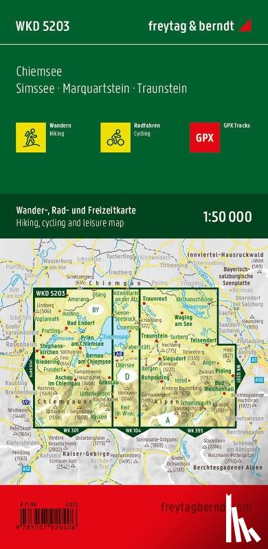
The Chiemsee forms the center of the map. Cycle and hiking trails close to the shore let him explore, lead to piers to visit Herreninsel and Fraueninsel. The routes through the rugged Chiemgau Alps (over 1,000 m above sea level) require fitness.
Ik heb een vraag over het boek:
‘Chiemsee, hiking, cycling and leisure map 1:50,000, freytag & berndt, WKD 5203, with info guide - ’.
Vul het onderstaande formulier in.
We zullen zo spoedig mogelijk antwoorden.