The German Coastal Defence System in the Netherlands 1940-1945
Omschrijving
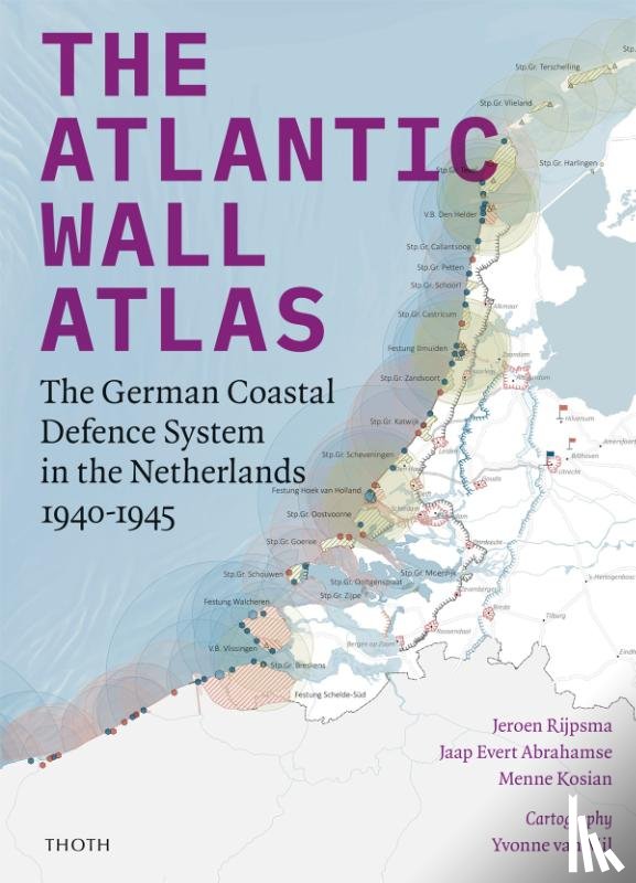
The west coast of continental Europe is scattered with countless remnants of one of the longest defence lines in history: the over five thousand kilometre-long Atlantic Wall. Stretching from the Arctic Cape to the Pyrenees, the Wall was intended to defend Hitler’s Third Reich against an Allied invasion. Over the course of the Second World War the line rapidly evolved into a multilayered network of coastal and inland defensive works that also supported Germany’s war campaign at sea and in the air.
While the main focus of The Atlantic Wall Atlas is on the Dutch section of the line, it is viewed from a European perspective. Rather than presenting the reader with an inventory of individual bunkers, field fortifications, obstacles and other structures in the Netherlands, this book provides insight into the (intended) functioning of German defensive systems in relation to one another.
The atlas consists of a general introduction, descriptions of various aspects of the Wall based on detailed maps, and a final reflection on dealing with the relics of the Atlantic Wall. The maps are interspersed with photographs, some never previously published, that illustrate how the German occupiers shaped the Dutch coastal landscape to suit their own purposes.
Ik heb een vraag over het boek:
‘The Atlantic Wall Atlas - Abrahamse, Jaap Evert, Kosian, Menne, Rijpsma, Jeroen’.
Vul het onderstaande formulier in.
We zullen zo spoedig mogelijk antwoorden.